--The 31th session of geology Lecture Hall in 2020 and
the academic activity to celebrate the 105th anniversary of Hohai University
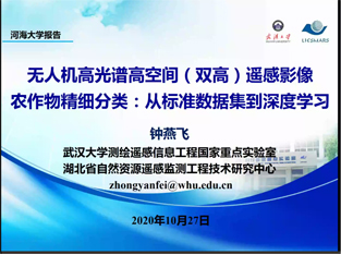
On the afternoon of October 27, at the invitation of Professor Su Hongjun of the Department of Surveying and Mapping Science and Engineering, Professor Zhong Yanfei of the Key Laboratory of Surveying and Mapping And Remote Sensing Information Engineering of Wuhan University delivered an online special report entitled UAV-borne Hyperspectral with High Spatial Resolution Hyperspace (H2) Remote Sensing Image Classifier for Precise Crop Recognition: From Standard Data Set to Deep Learning Classification. This report was hosted by Professor Su Hongjun from the Department of Surveying and Mapping Science and Engineering. More than 140 teachers and students of our school participated in the online academic report.
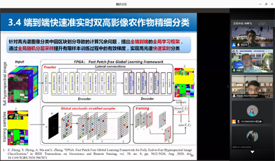
According to the characteristics of land use fragmentation in China, the paper takes the fine classification of hyperspectral crops as the research background, and introduces the related research progress of the precise crop recognition of UAV-borne hyperspectral with high spatial resolution hyperspace (H2) remote sensing image from the perspectives of standard data set, deep learning model and agricultural remote sensing application. In view of the limitations of traditional space-spectral classification methods for H2 images, a deep learning hyperspectral classification method based on the convolutional neural network fusion of deep spectral-spatial feature and Patch based was proposed by referring to the idea of deep learning. For deep learning classification methods are faced with the problem in the combination image crop classification, put forward the global spectral-spatial image fusion combination crop classification method and the fast patch-free global learning framework for fully end-to-end hyperspectral image classification method, effectively improve the classification accuracy and computational efficiency, the data set of the above methods in WHU - Hi achieved good classification effect. In addition, Professor Zhong put forward three suggestions for the precise crops classification of hyperspectral: constructing the benchmark data set, optimizing the classification model, and extending the application of the algorithm. At last, in the interactive part, Professor Zhong patiently answered the students' questions and gave them effective Suggestions for future research.
Professor Zhong's report was rich in content and closely related to practical application, which provided effective scientific means for the development of agricultural remote sensing in China and benefited the teachers and students attending the meeting.

