It is of great significance for government to conduct policy intervention and urban resource scheduling in the case of air pollution to understand the temporal and spatial changes of people's behavior patterns under heavy smog. Rui Xiaoping's research group proposed a method to generate population density distribution based on cellphone signaling data with high efficiency. DCGAN was used to generate virtual verification environment, random sampling was used to generate virtual CDR based on this environment. The proposed estimation method is used to calculate the CDR, and the obtained estimation results are compared with the virtual population density distribution, which verifies the stability and accuracy of the algorithm. High-precision spatial estimation method for PM2.5 was proposed. On the basis of correcting AOD data, XGBoost algorithm is used to build the relationship model between PM2.5 and AOD, NDVI, wind field, rainfall and other factors. Pm.25 spatial distribution data are generated by this model. ConsLSTM algorithm was used to predict population density and PM2.5 data in space. POI data were used to extract different types of activity modes, and fixed effect models were used to analyze the relationship between population density and air quality from the four aspects of play, dining, living and traveling. Different types of correlation coefficients satisfying the significance test were obtained to represent the degree of influence of population density on air quality or PM2.5.

The report starts with the introduction of evapotranspiration concept, application, estimation method and inversion model, and summarizes some problems of evapotranspiration remote sensing inversion model. On this basis, the study from the perspective of input data, model construction and timing monitoring these three contexts, the report introduces the data source, process, error, system development and application of all-space multi-scale evapotranspiration remote sensing inversion. The report was rich in content and the speech was excellent. At last, the interactive part of the report is discussed, Associate professor Pan gave detailed answers to the questions raised by the online teachers and students, and had a heated discussion and exchange with his teachers and students on relevant scientific issues. Through the exchange of this academic conference, the attending teachers and students have a deeper understanding of evapotranspiration remote sensing.

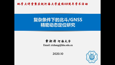
Aiming at the problem of BeiDou/GNSS precision positioning in complex conditions, Dr. Zhetao Zhang focused on the theory and method for processing the unmodeled error, including the basic properties of unmodeled errors, the theory of hypothesis testing for unmodeled errors, a weighting model considering the unmodeled errors, an efficient approximation for a fully populated variance-covariance matrix, the functional model compensation considering the unmodeled errors, several kinematic data processing methods for time-correlated observations and a signal noise assessment method for suppressing the unmodeled errors. Through this academic exchange, we have a further understanding of BeiDou/GNSS precise positioning.

Dr. Zhuang, Chao first introduced the research background and significance of aquitard layers in groundwater resource depletion and land subsidence, an pointed out the critical role of aquitard hydraulic parameters. Then, this report focused on the periodic hydraulic head variations and elastic deformation of an overconsolidated aquitard. An analytical solution for the elastic aquitard deformation caused by periodic hydraulic head variations (PHHV) within adjacent aquifers is consequently derived using the separation of variables method based on Euler’s formula. The phase difference in PHHV between adjacent aquifers is found to reduce the amplitude of periodic aquitard deformation. Meanwhile, the phase difference is found to cause no influence on the growth pattern of the phase shift, which is between the periodic aquitard deformation and PHHV, versus the period. A new parameter estimation method is further proposed to interpret aquitard  and
and  from periodic aquitard deformation data. This new method yields robust
  and
and  estimates of a moderately thick aquitard, whose deformation history has been recorded by an extensometer, located in Shanghai, China. The field study confirms that the phase difference in PHHV between the aquifers adjacent to the overconsolidated aquitard of interest cannot be ignored. Future research topic could focus on the elastic-inelastic deformation characteristics under the conditions of PHHV and associated parameter estimation methods.

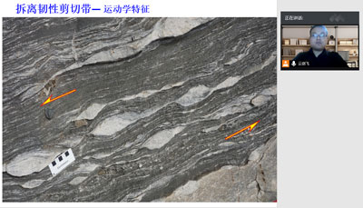
In the afternoon of October 16th, 2020, Dr. Yunjian Li gave a lecture titled “Destruction of the North China Craton-shallow tectonic response”, through web meeting. Dr. Li first briefly introduced the definition of the craton and the remarkable characteristics of the destruction of the North China Craton. Subsequently, took Xiaoqinling metamorphic core complex which in the southern margin of the North China Craton as an example, by analyzing its geometry, kinematics, chronology, deformation temperature and model, revealed the tectonic evolution process and mechanism of the Xiaoqinling metamorphic core complex. Further more, combined with the deformation features and evolution mechanism of the Kalaqin, Waziyu, Yunmengshan and Linglong metamorphic core complex in North China Craton, systematically discussed the time, scope and dynamic mechanism of the destruction of the North China Craton.

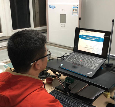
On October 16, 2020, Dr. Peng Chen of our college gave a wonderful report entitled Relationship between soil 10Be isotope and its implications on tracing historic precipitation to all teachers and students. The report introduced an isotope which could be used to trace precipitation information from soil samples and also its tracing mechanism. The report specified the background knowledge of the characteristics, production and transportation processes of Beryllium-10. Meanwhile, the study resolved the opposite trends of 10Be-precipitation relationships in high and low precipitation regions, based on sampling at large scales, also with measurements and analysis. In addition, through the isotopic deposition modeling results based on general circulation model (GCM), the study estimated the residence time of the isotope, which was verified by the Carbon-14 dating technology. The study provided new understandings on the spatial distribution of precipitation on mainland China under the Asian summer monsoons at the millennial scale.
